Romsdalseggen
Hike along the Romsdalseggen ridge to the Mjølvafjellet peak (1216 m)
2024/06
Norway 
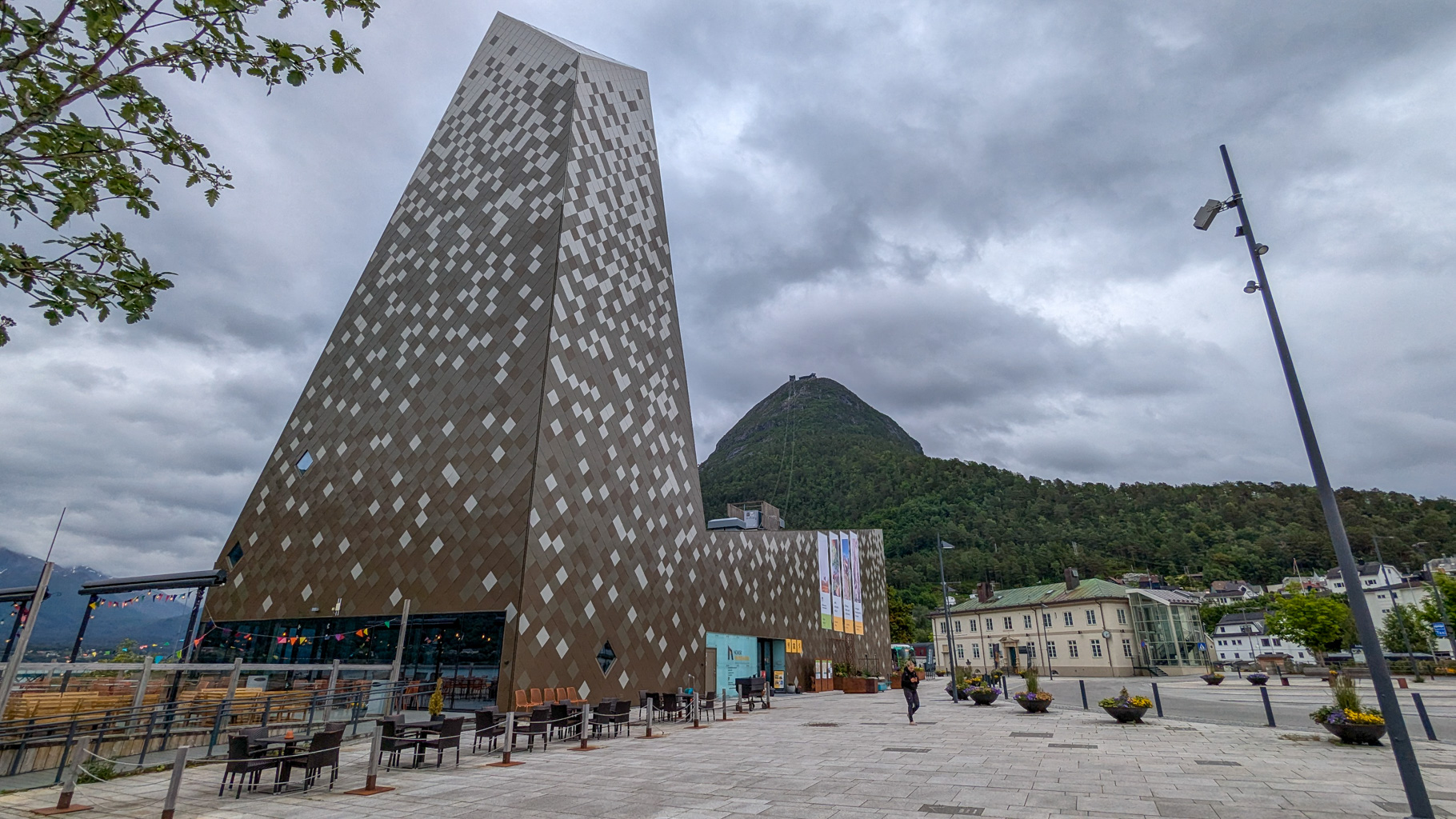
Photo 1: The modern Romsdalsgondolen cable car starts from the centre of Åndalsnes up to the Nesaksla summit - the gateway to the Romsdalseggen ridge. Opened in 2021, the ride takes just 5 minutes.
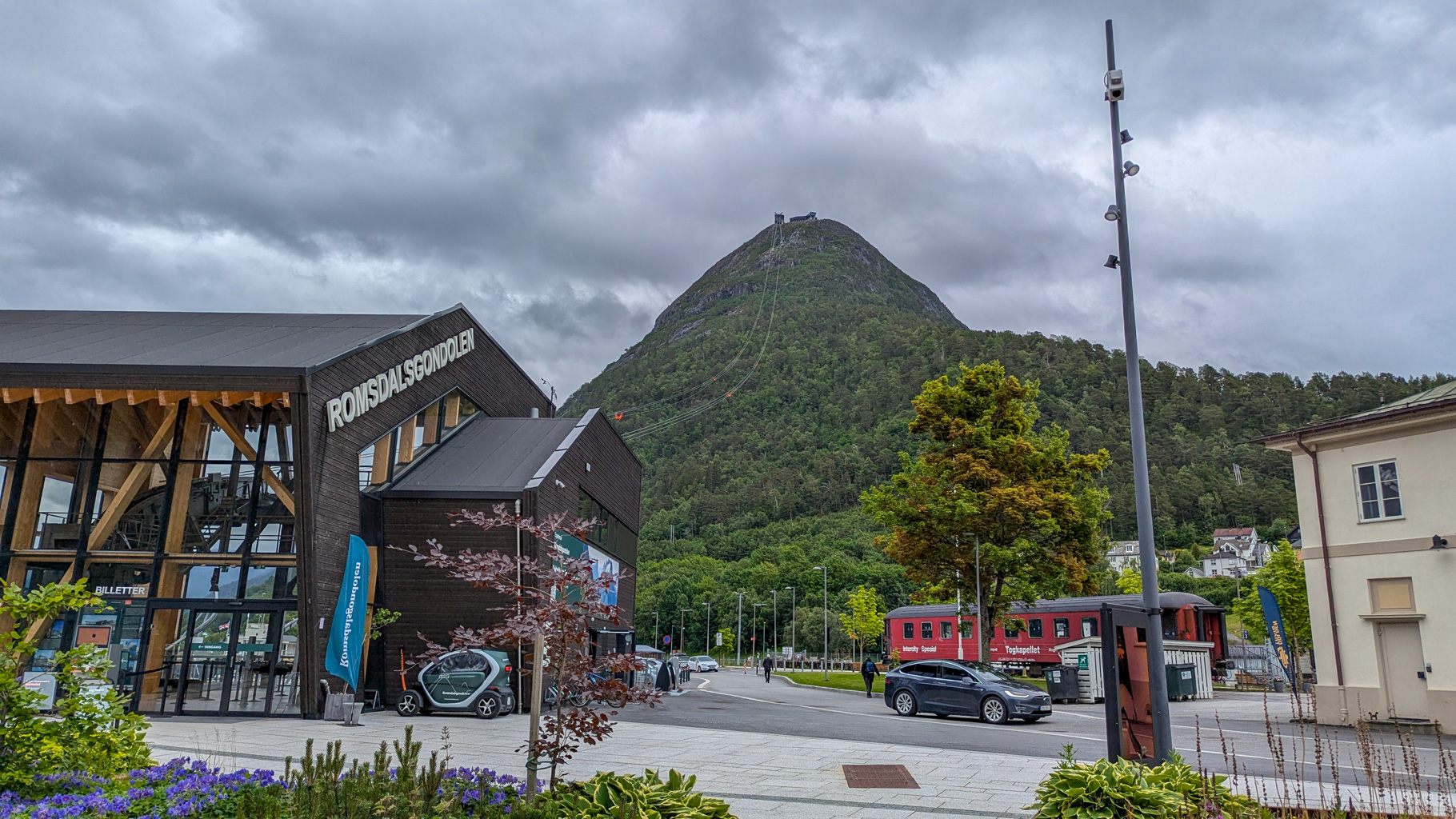
Photo 2: View of the steep Nesaksla peak with the cable car and the Romsdalsgondolen building. From here begins the adventurous hike to Mjølvafjellet. Nesaksla (715 m) is one of the landmarks of Åndalsnes.
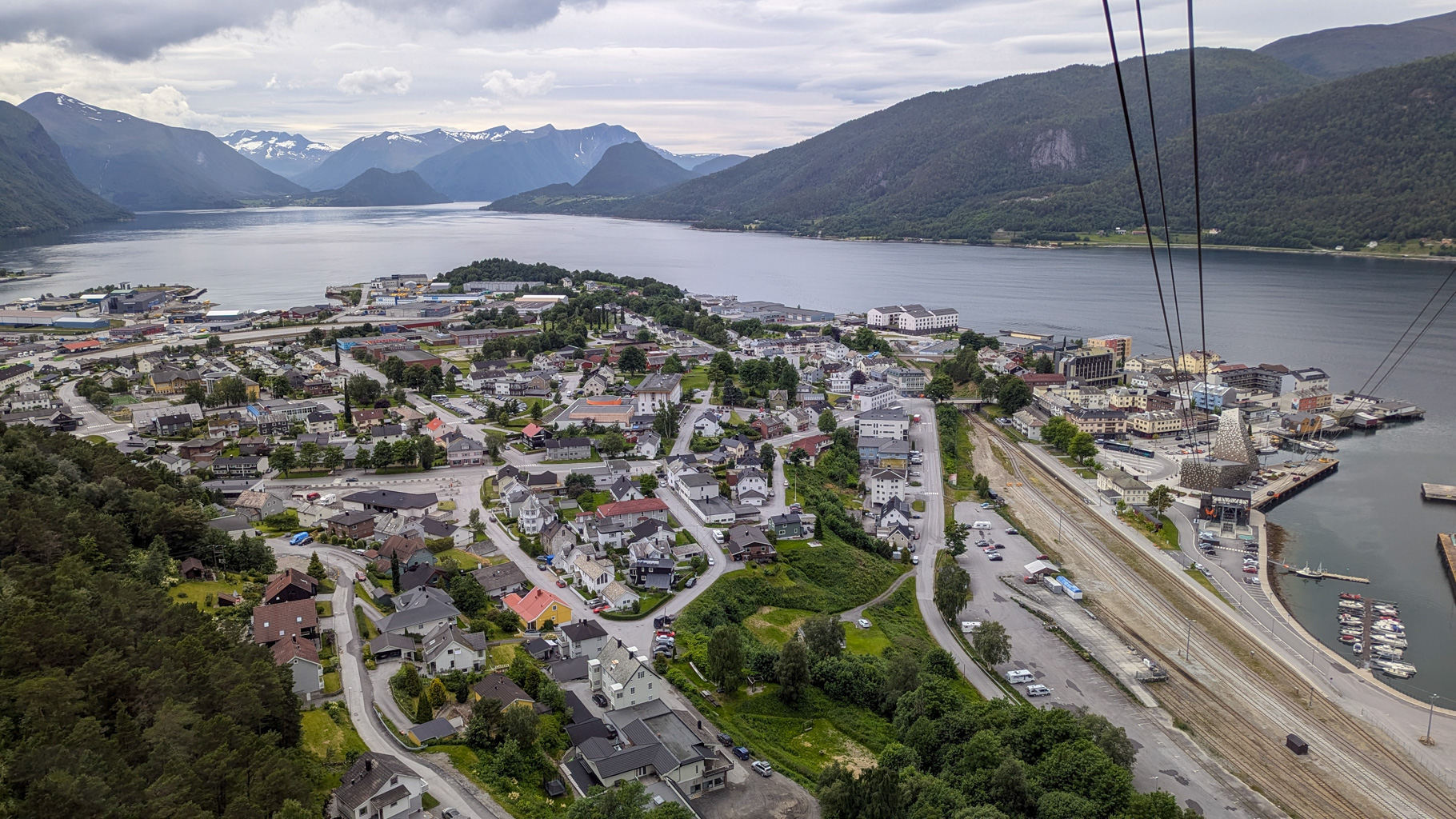
Photo 3: Panoramic view from the cable car of the town of Åndalsnes, where the Rauma river flows into Romsdalsfjord. Åndalsnes is known as the "alpine town by the sea".
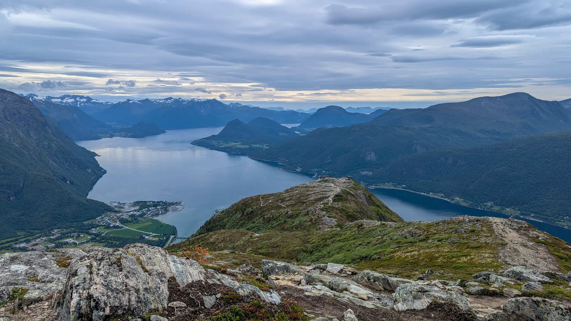
Photo 4: View from the Romsdalseggen ridge of Romsdalsfjord, the town of Åndalsnes and the surrounding snow-capped peaks
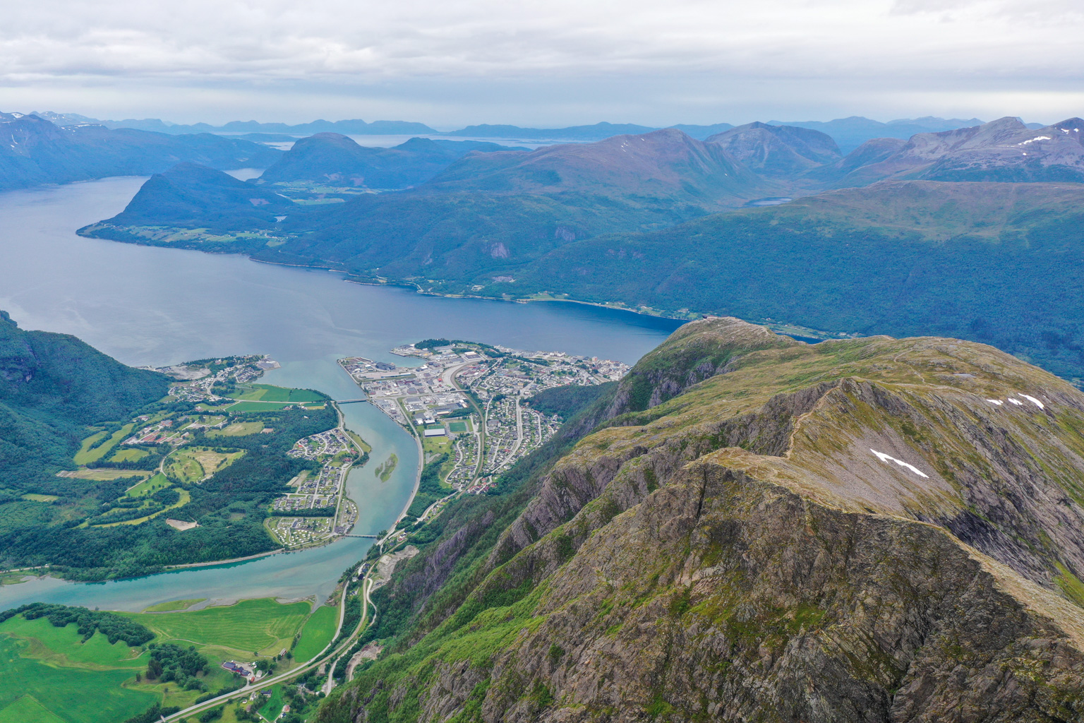
Photo 5: Aerial view of Romsdalseggen with the winding trail running along the sharp ridge. The route is popular for its combination of exposed sections and panoramic views.
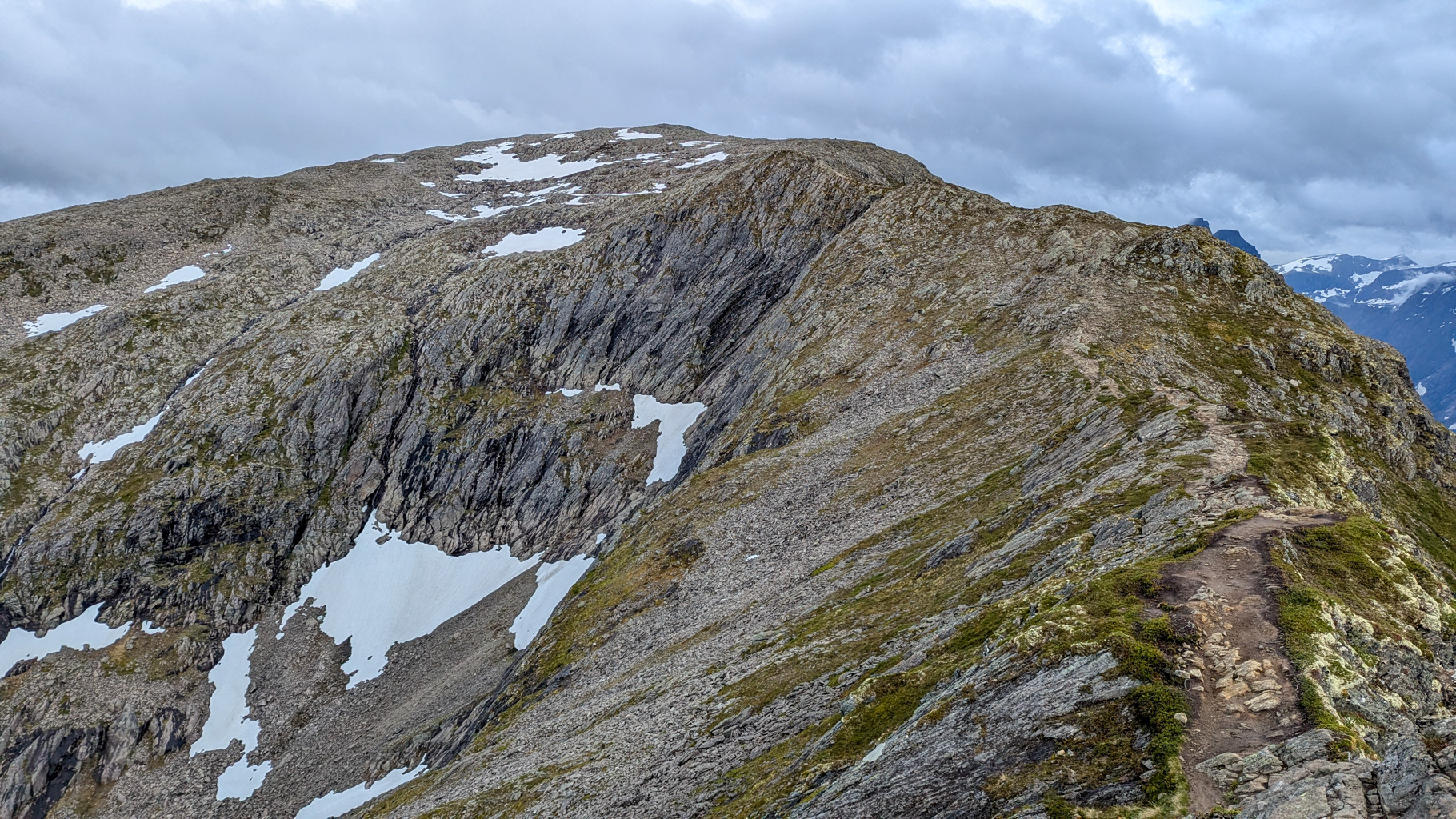
Photo 6: Narrow ridge approaching the Høgaksla summit, with views of the steep drops and snow-capped peaks around.
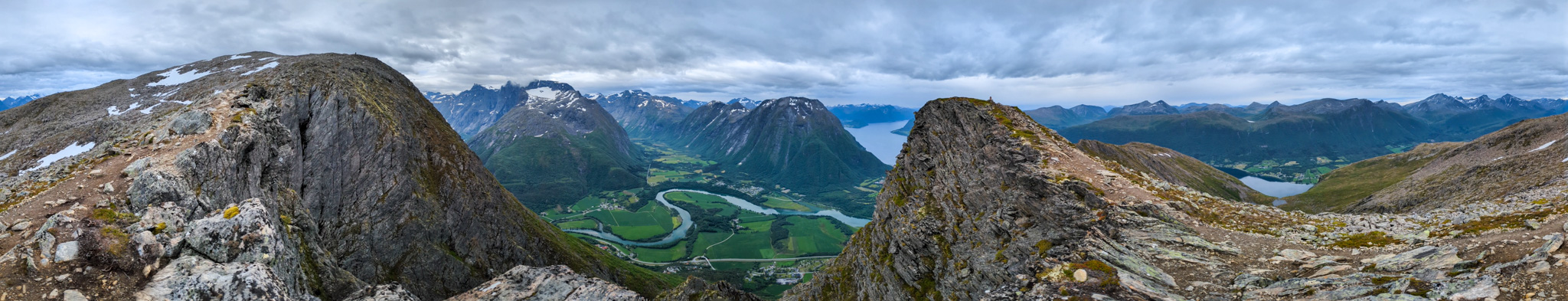
Photo 7: Panoramic view from the Romsdalseggen ridge of the alpine scenery of northwestern Norway
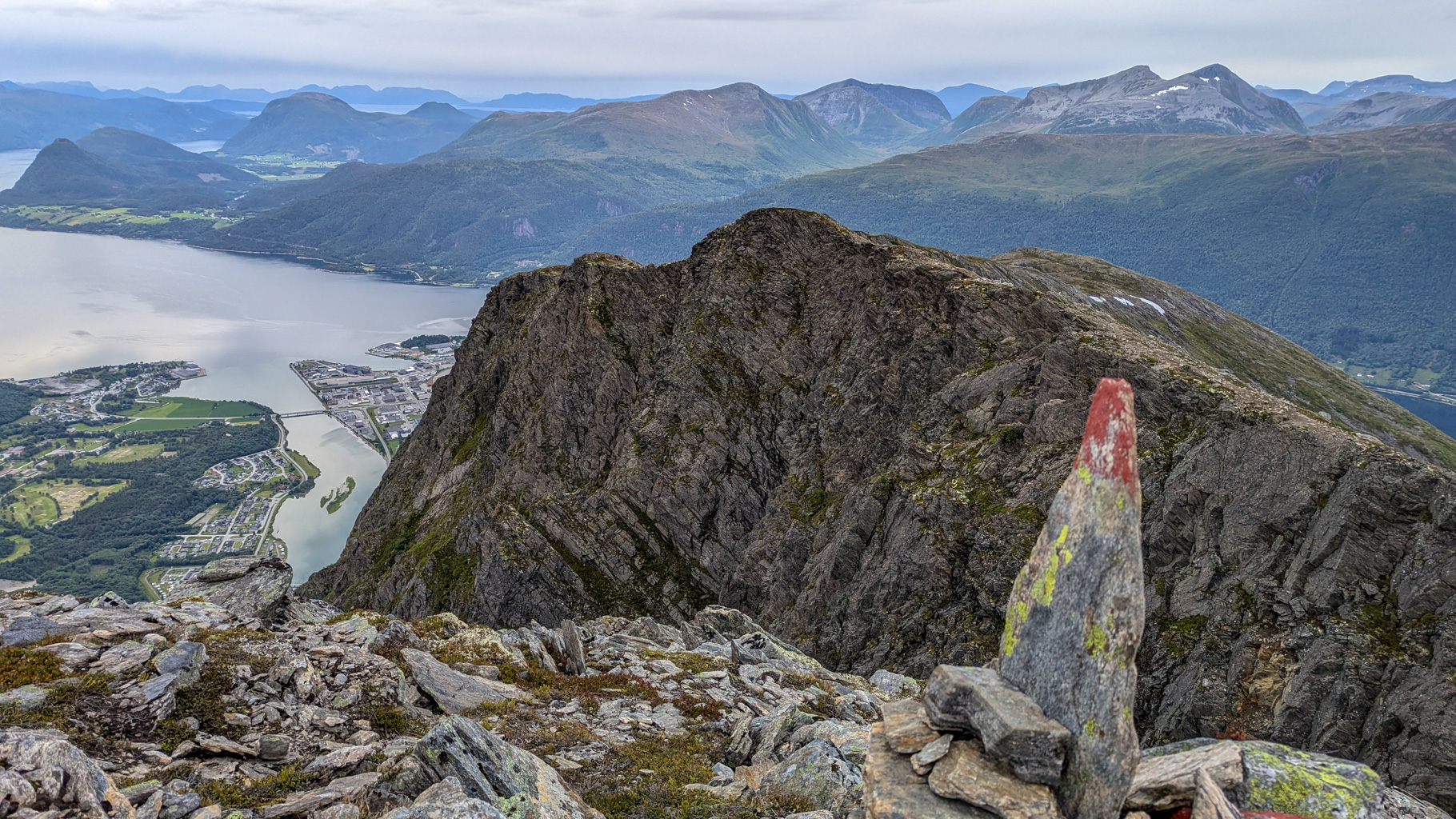
Photo 8: A painted cairn marking the trail with a view of the town of Åndalsnes below the ridge. The trail markers are clearly visible along the route, improving both safety and orientation.
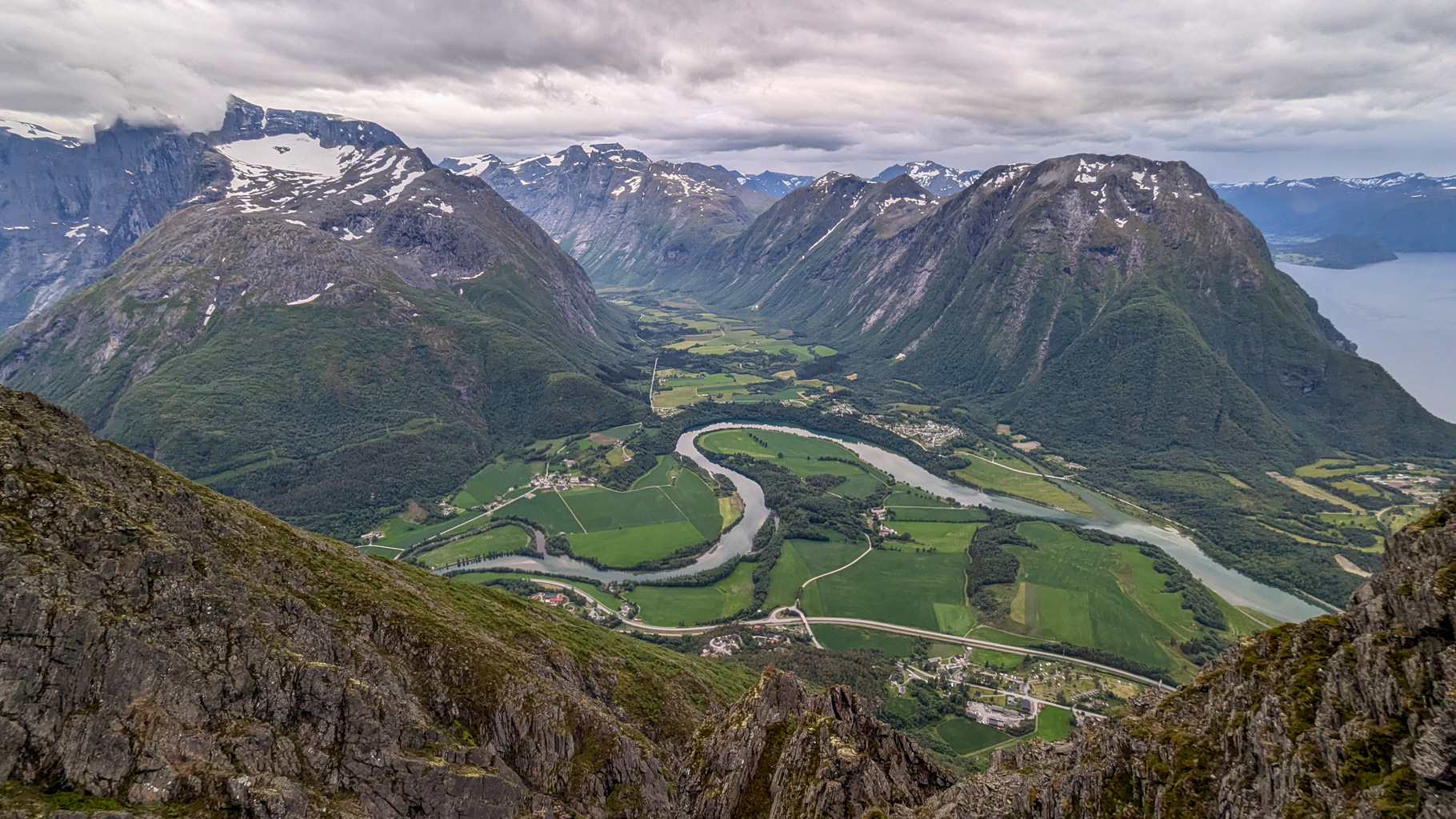
Photo 9: View from the Høgaksla summit (991 m) towards the Rauma river valley - the contrast of mountains, river and sea makes this hike exceptional.
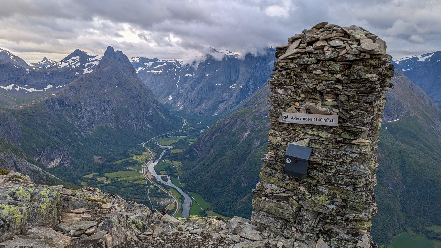
Photo 10: View from the Åkesvarden summit (1140 m), one of the peaks on the ridge, of the Rauma river valley with Trollstigen in the distance. The stone cairn at the top is a classic destination of the hike.
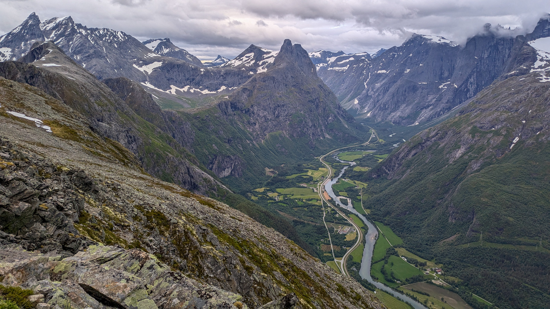
Photo 11: Trollveggen (the Troll Wall) in the background - Europe's tallest vertical rock face dominates the view from the Romsdalseggen trail. It rises more than 1000 metres high.
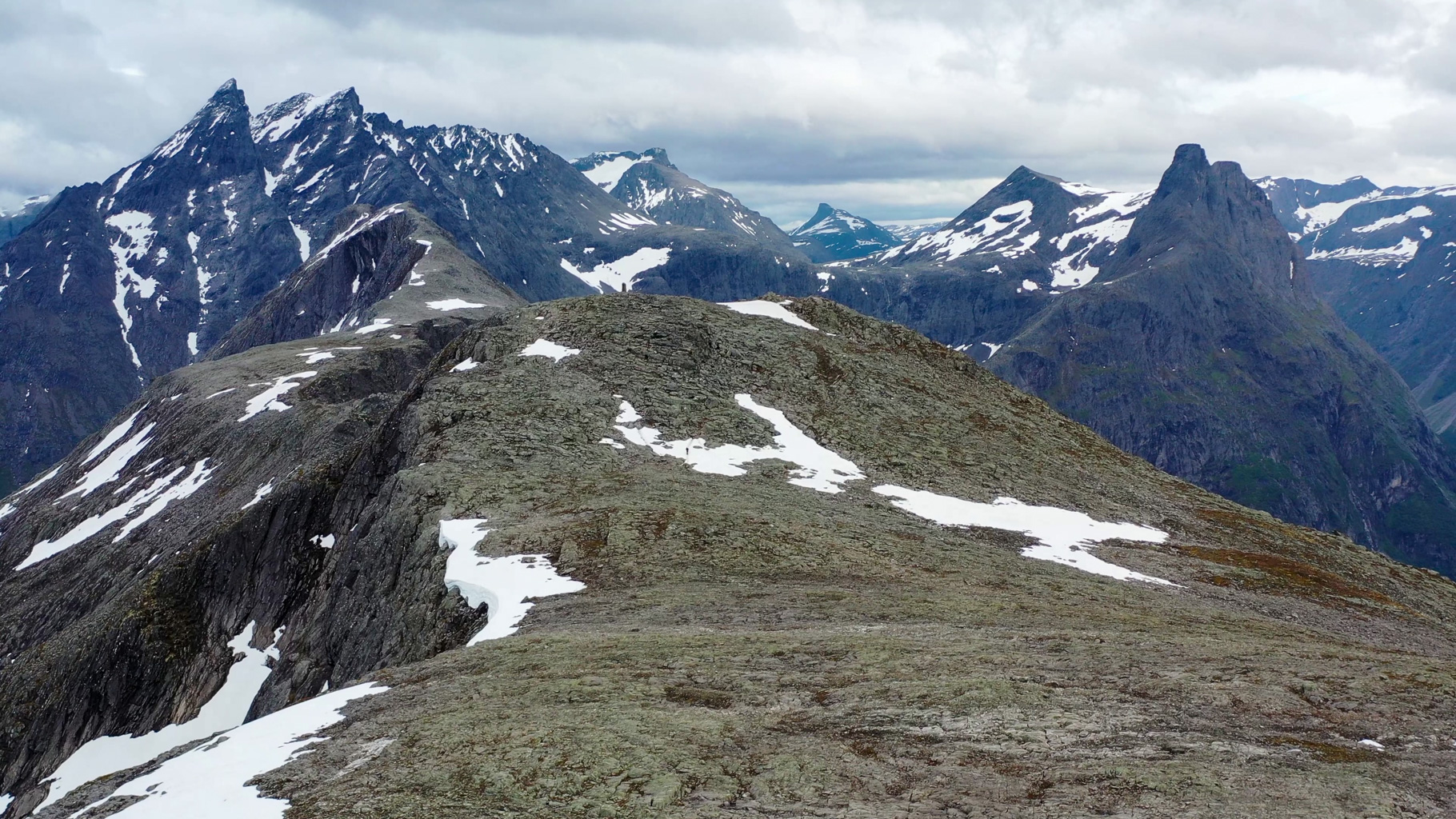
Photo 12: Snow-capped peaks. In the foreground Mjølvafjellet (1216 m), behind it Blånebba (1320 m) and the iconic Romsdalshornet (1550 m), popular among climbers.
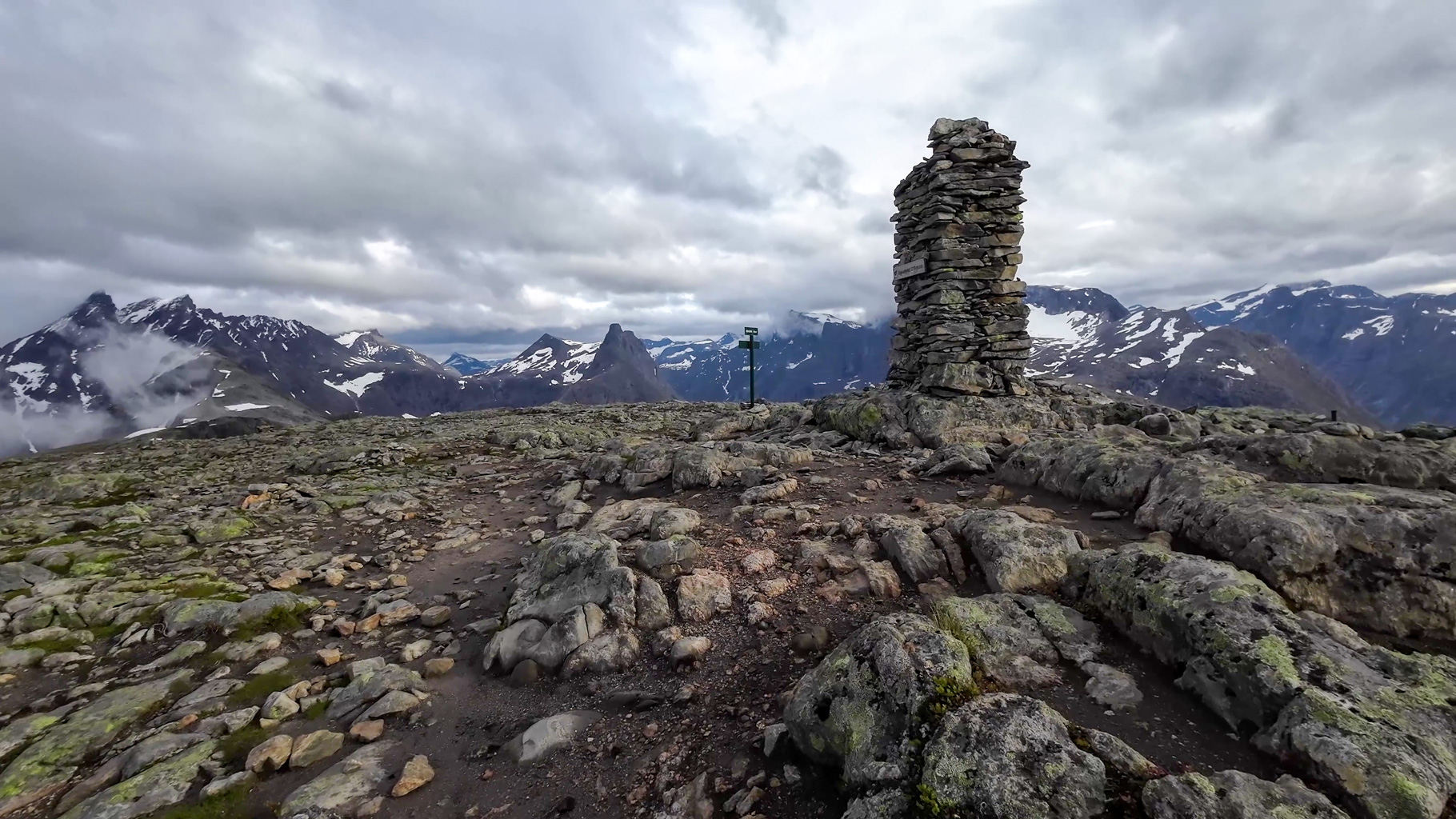
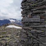
Photo 13: Stone cairn marking the Mjølvafjellet summit (1216 m). From this point opens a 360-degree view of the entire Romsdalen region.
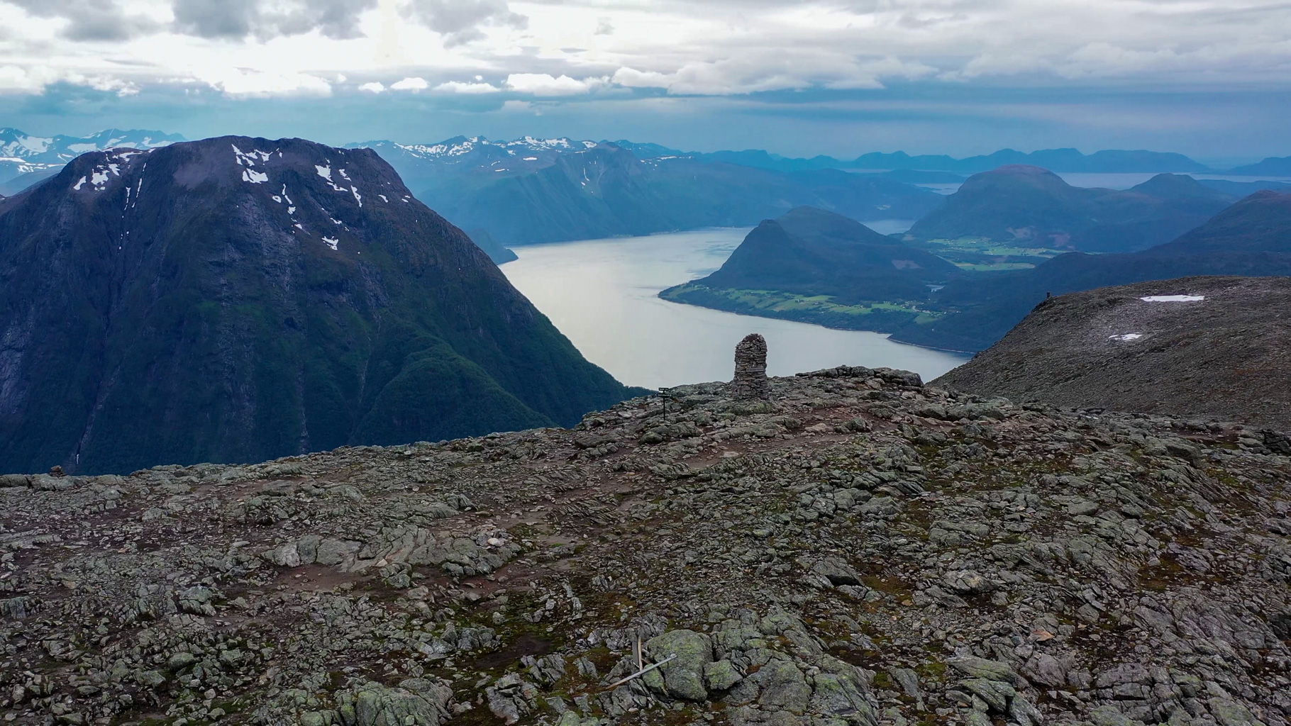
Photo 14: View of Mjølvafjellet, Romsdalsfjord and the rugged coastline from the heights of the ridge - a breathtaking reward during the hike.
Video from the hike along Romsdalseggen to the Mjølvafjellet summit.