Trollstigen, Stabbeskaret
Hike along the Trollstigen road and up to the Stabbeskaret pass
2024/06
Norway 
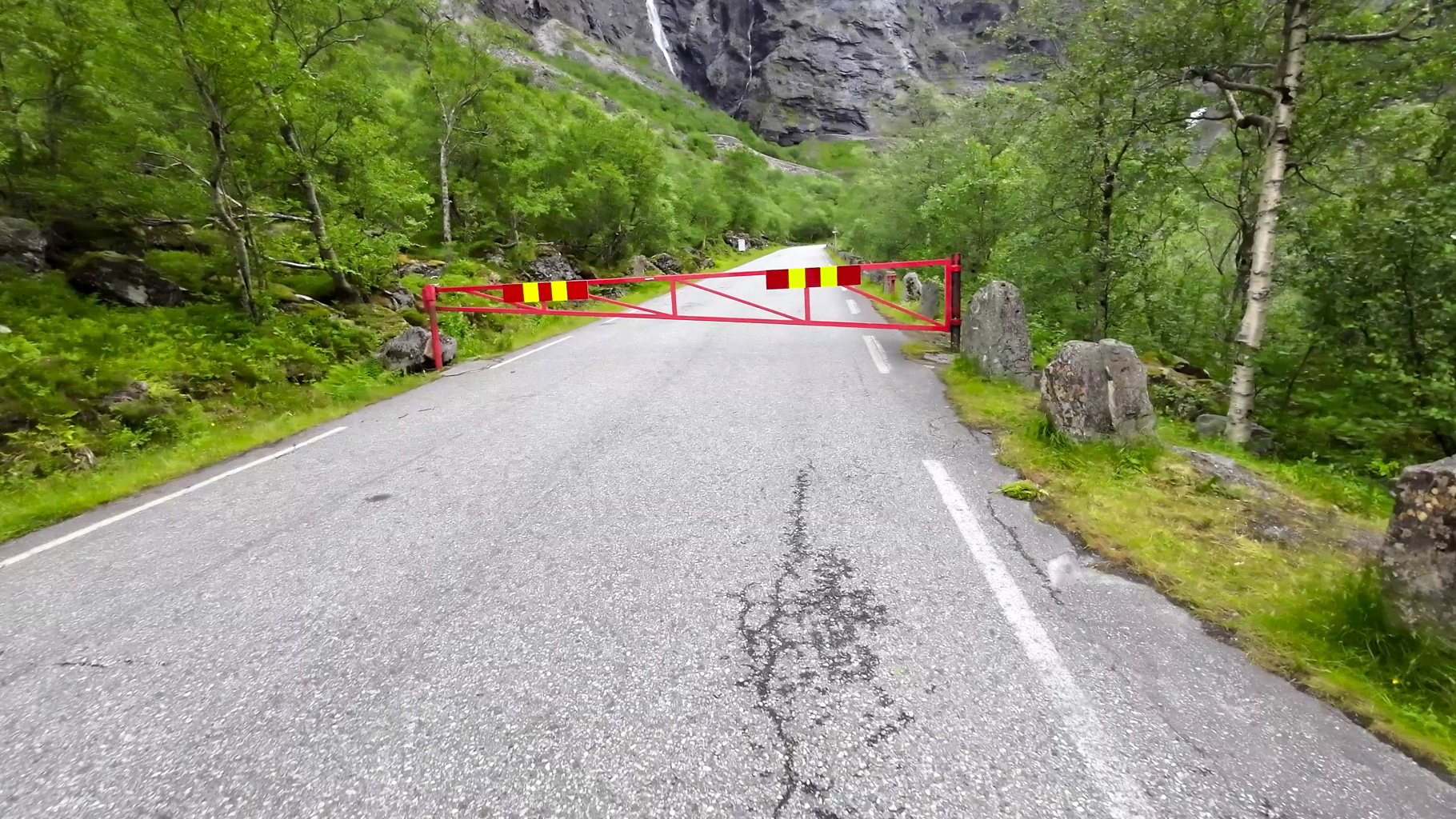
Photo 1: Closed section of the Trollstigen road with a barrier. Access is only possible on foot.
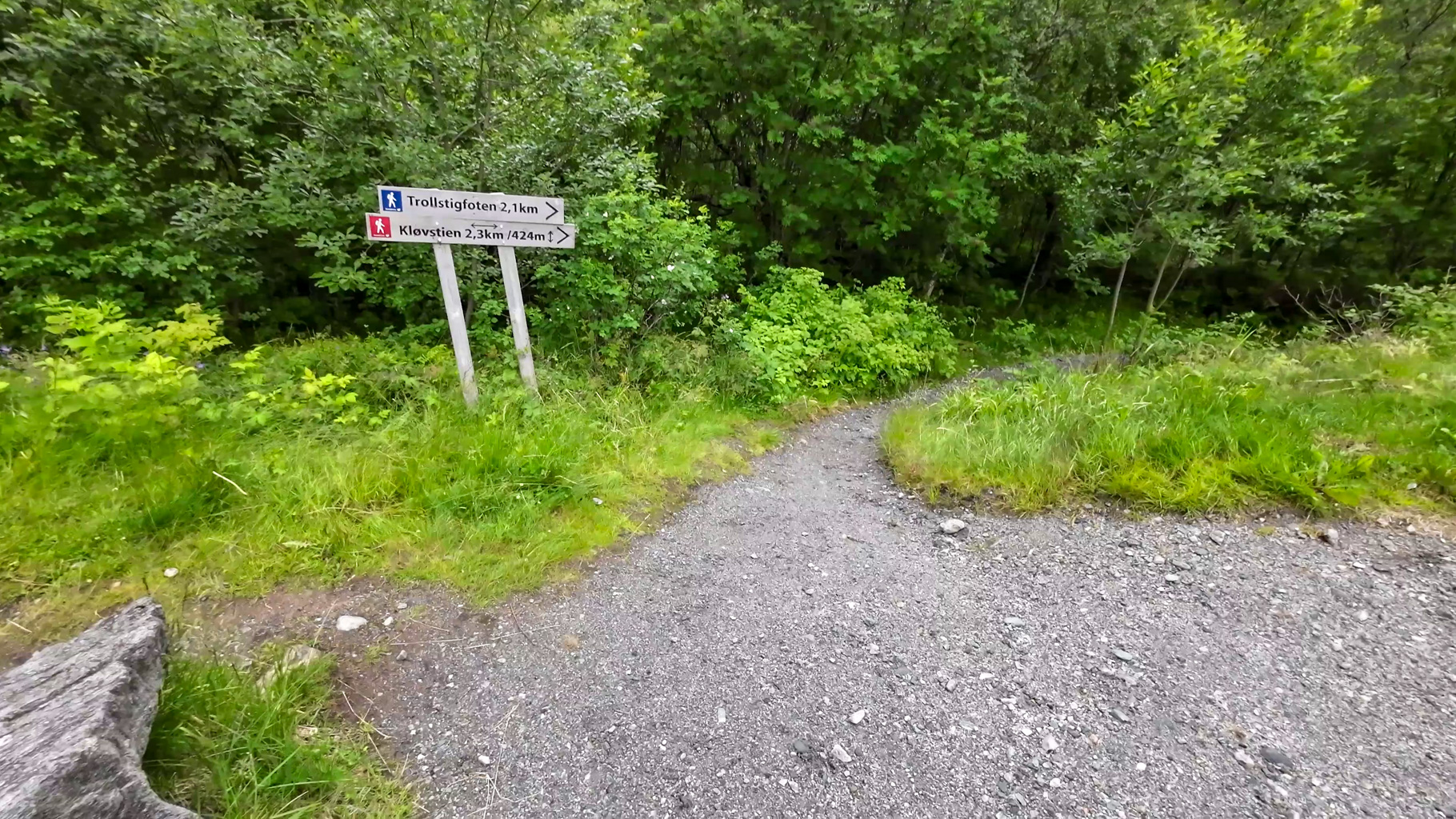
Photo 2: Trail signpost at the start of the route showing the direction to the Trollstigfoten viewpoint and the Kløvstien path.
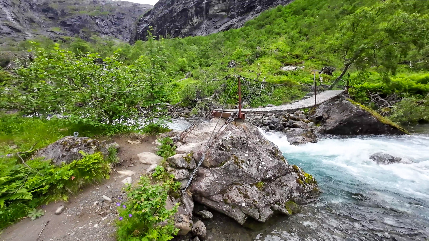
Photo 3: Pedestrian bridge over a mountain stream on the Kløvstien trail.
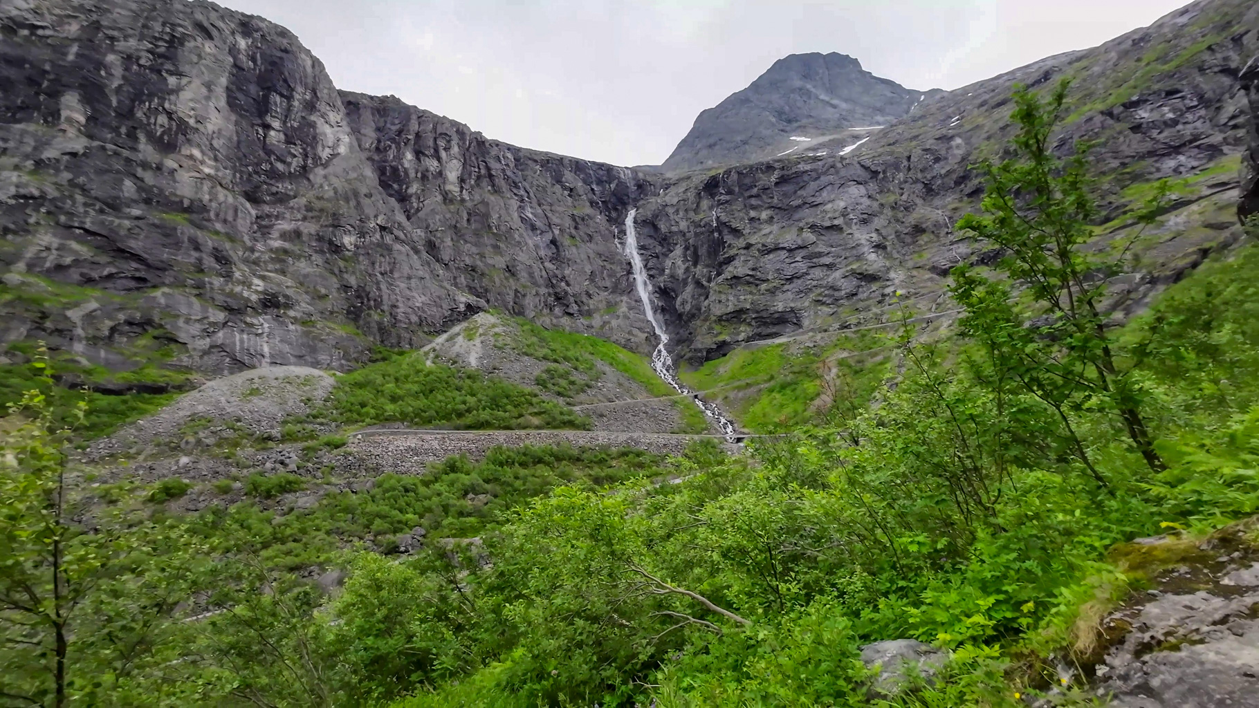
Photo 4: The Stigfossen waterfall, cascading down the mountain massif from a height of 320 metres.
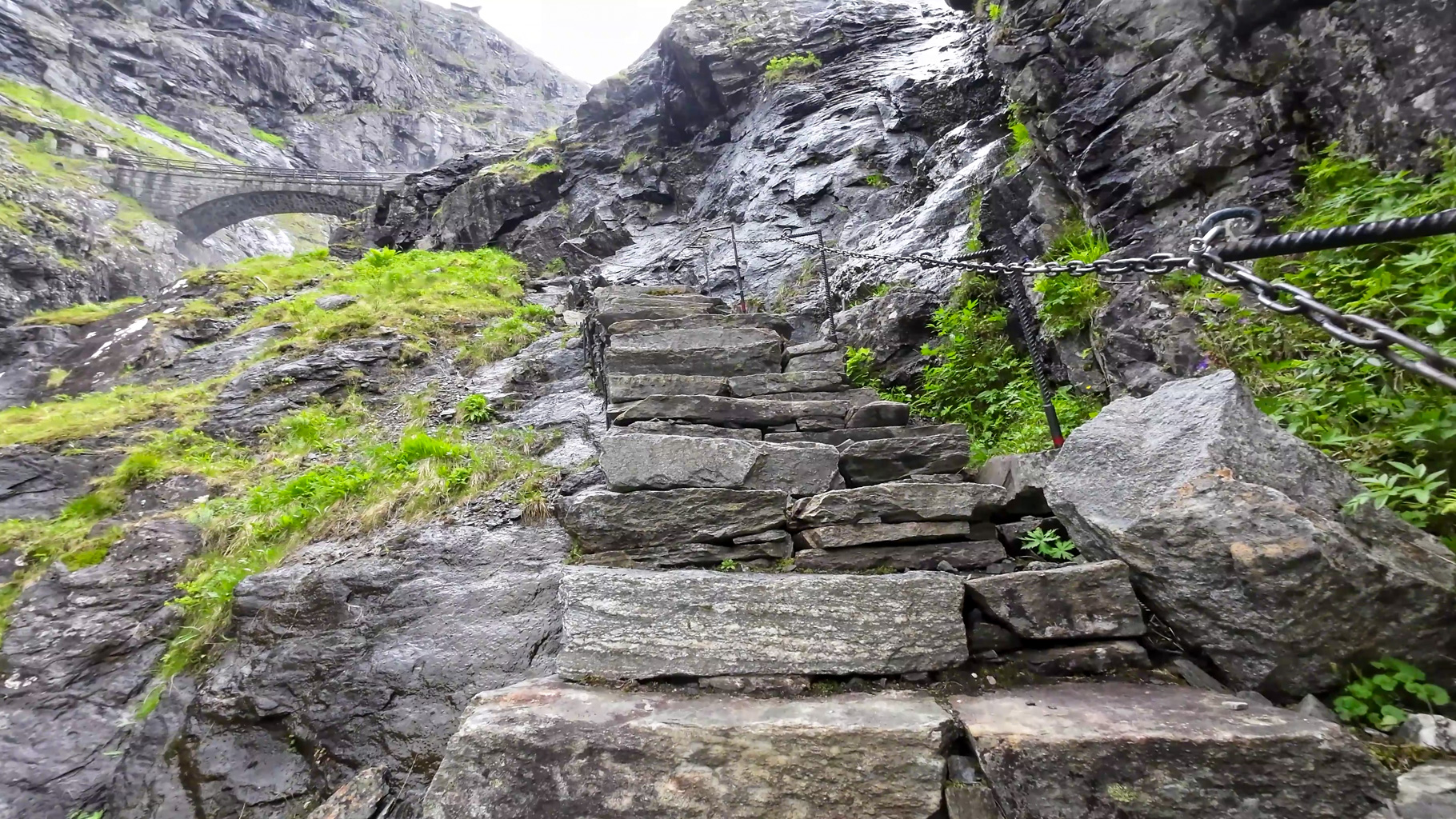
Photo 5: Steep stone-paved section with safety chains leading up to the bridge above the waterfall.
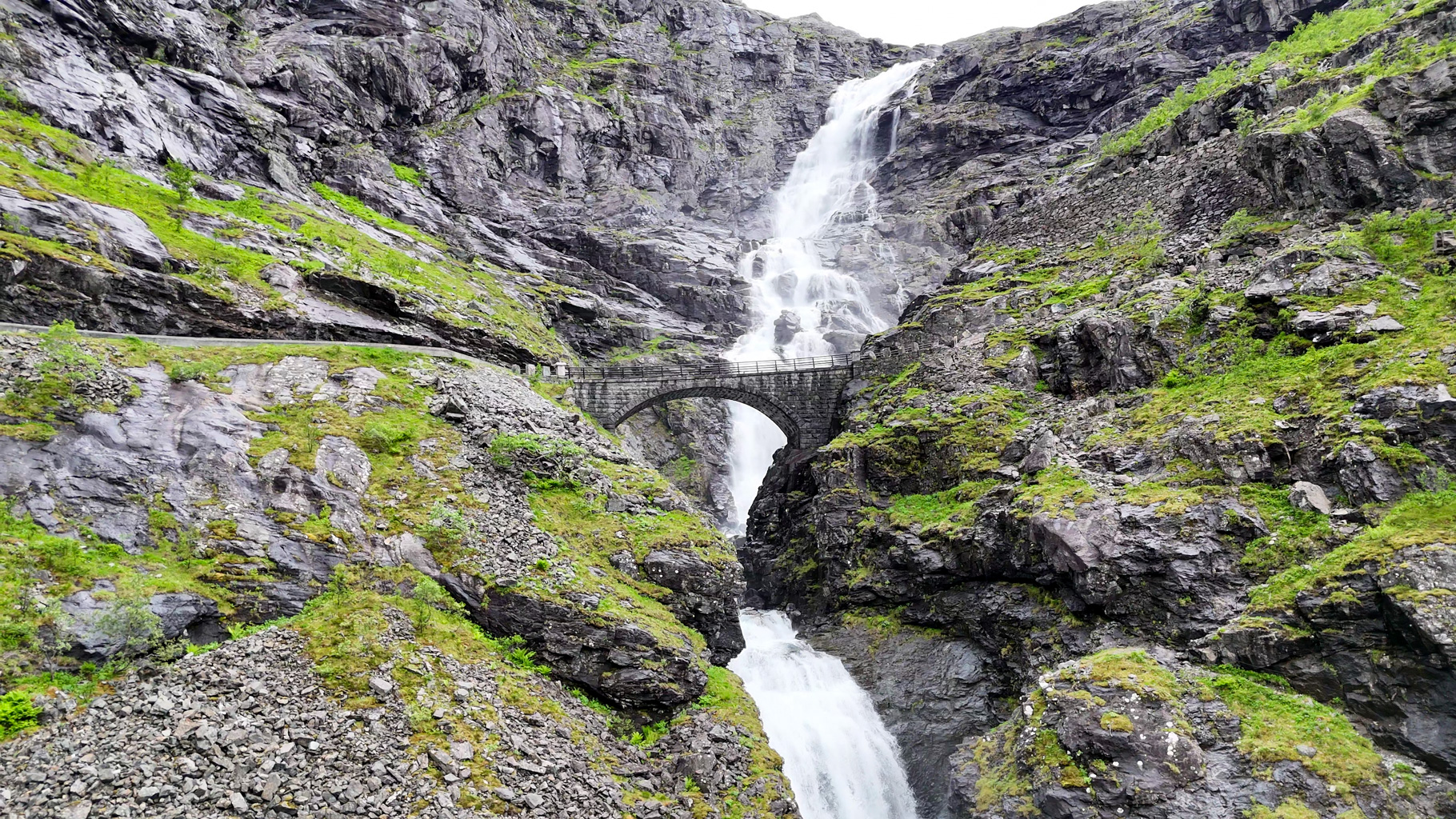
Photo 6: Arched stone bridge over the Stigfossen waterfall, built in 1936.
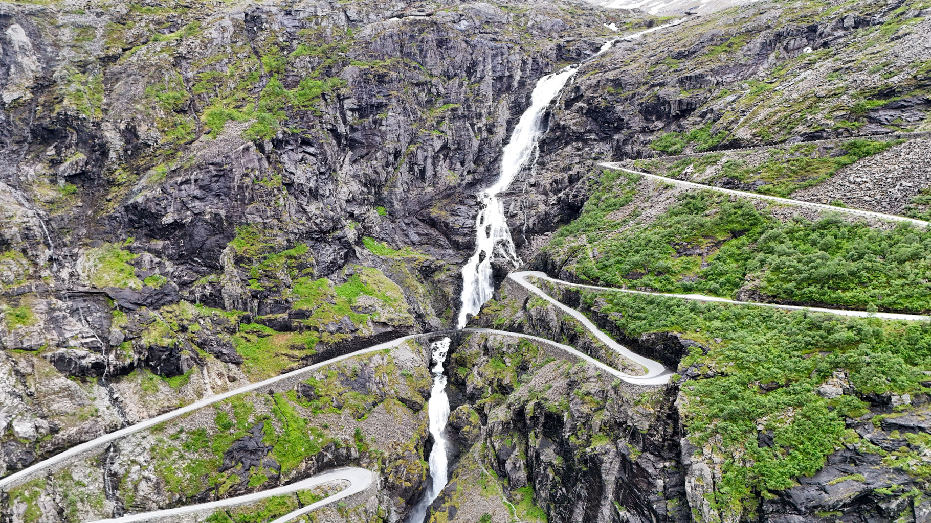
Photo 7: View of the Trollstigen serpentines and the Stigfossen waterfall flowing down the middle of the valley.
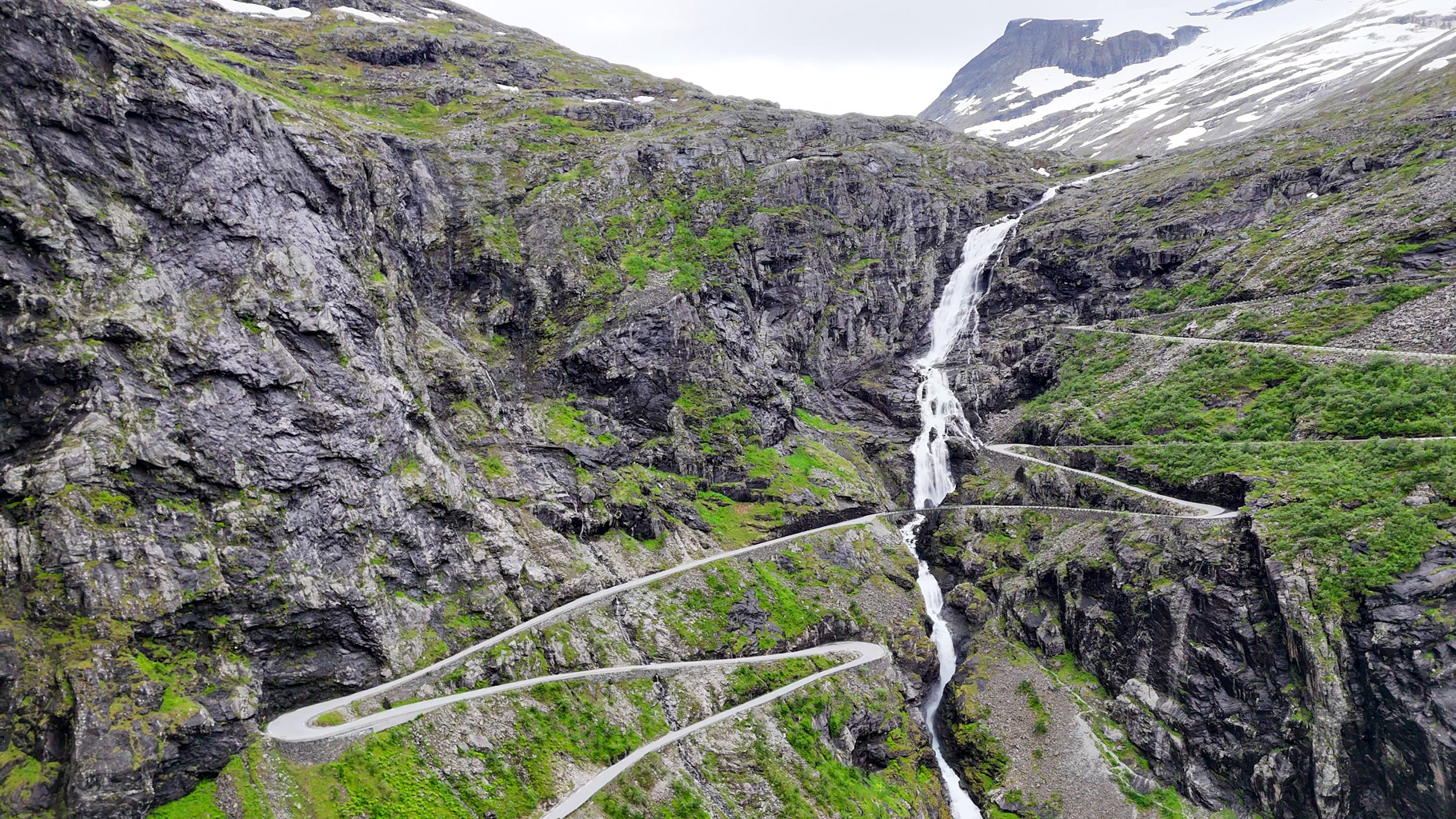
Photo 8: Aerial view of the Stigfossen waterfall and the empty Trolls' Road.
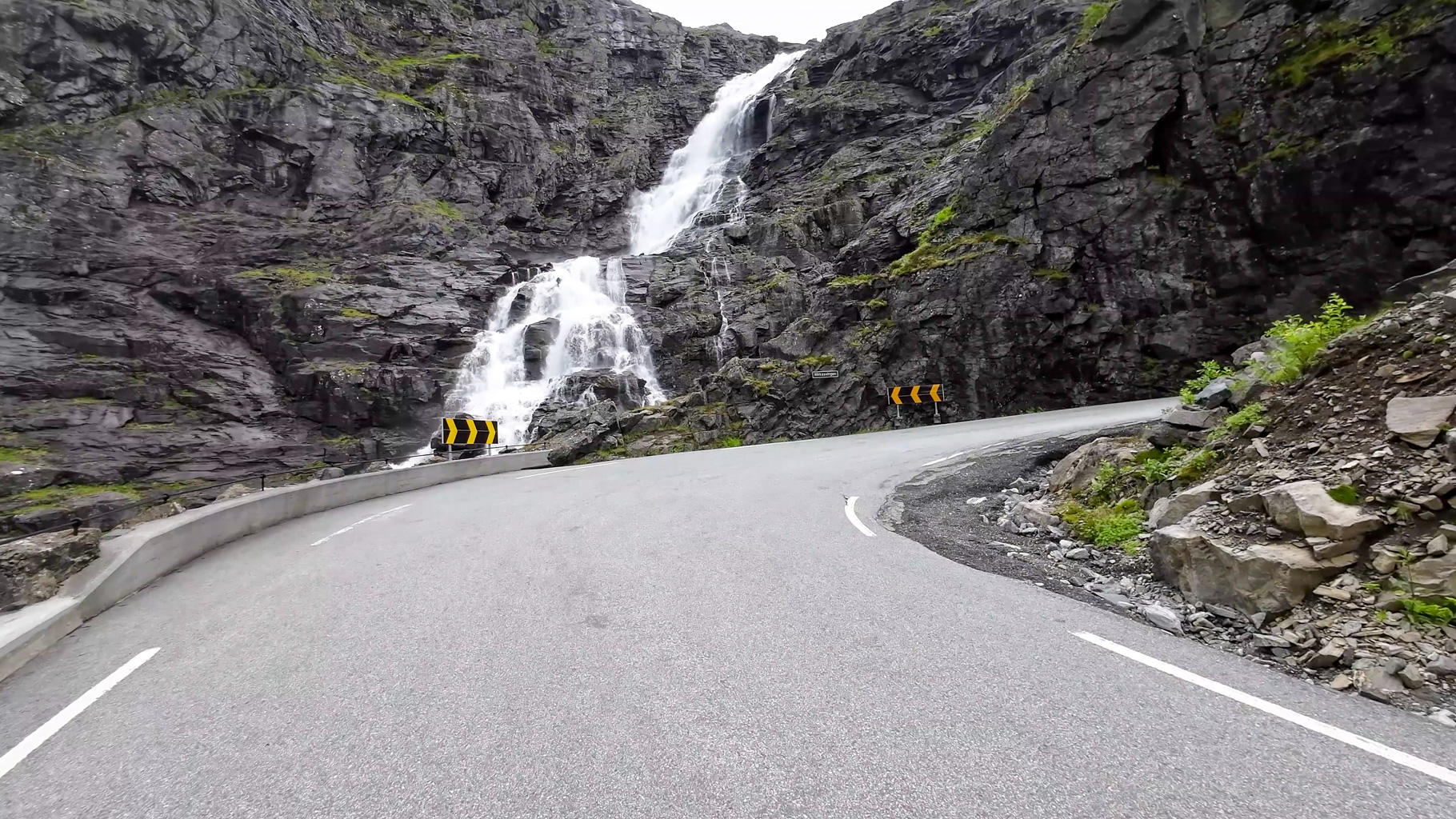
Photo 9: A section of the trail follows the asphalt Trollstigvegen road - this time without any cars.
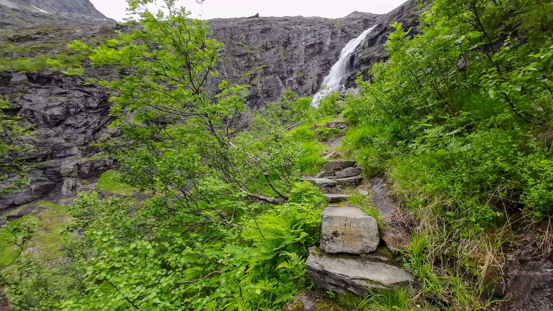
Photo 10: Climbing the mountain trail towards the Trollstigen visitor centre.
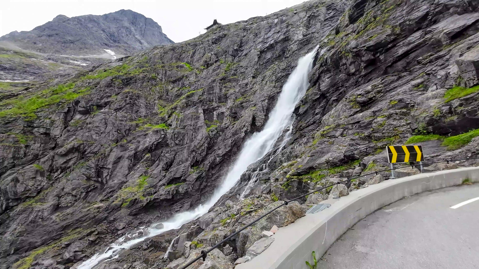
Photo 11: Trollstigen serpentines and a view of the Stigfossen waterfall from the upper part of the road.
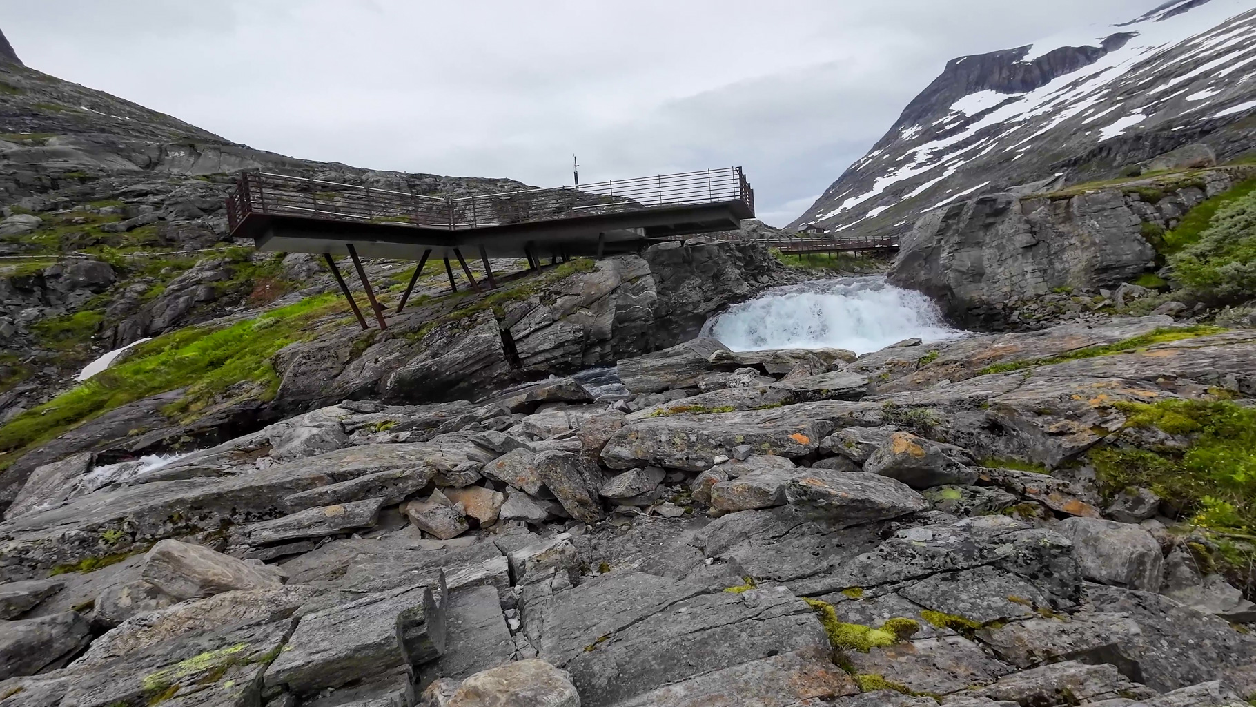
Photo 12: Observation deck at the Trollstigen visitor centre overlooking the river and waterfall.
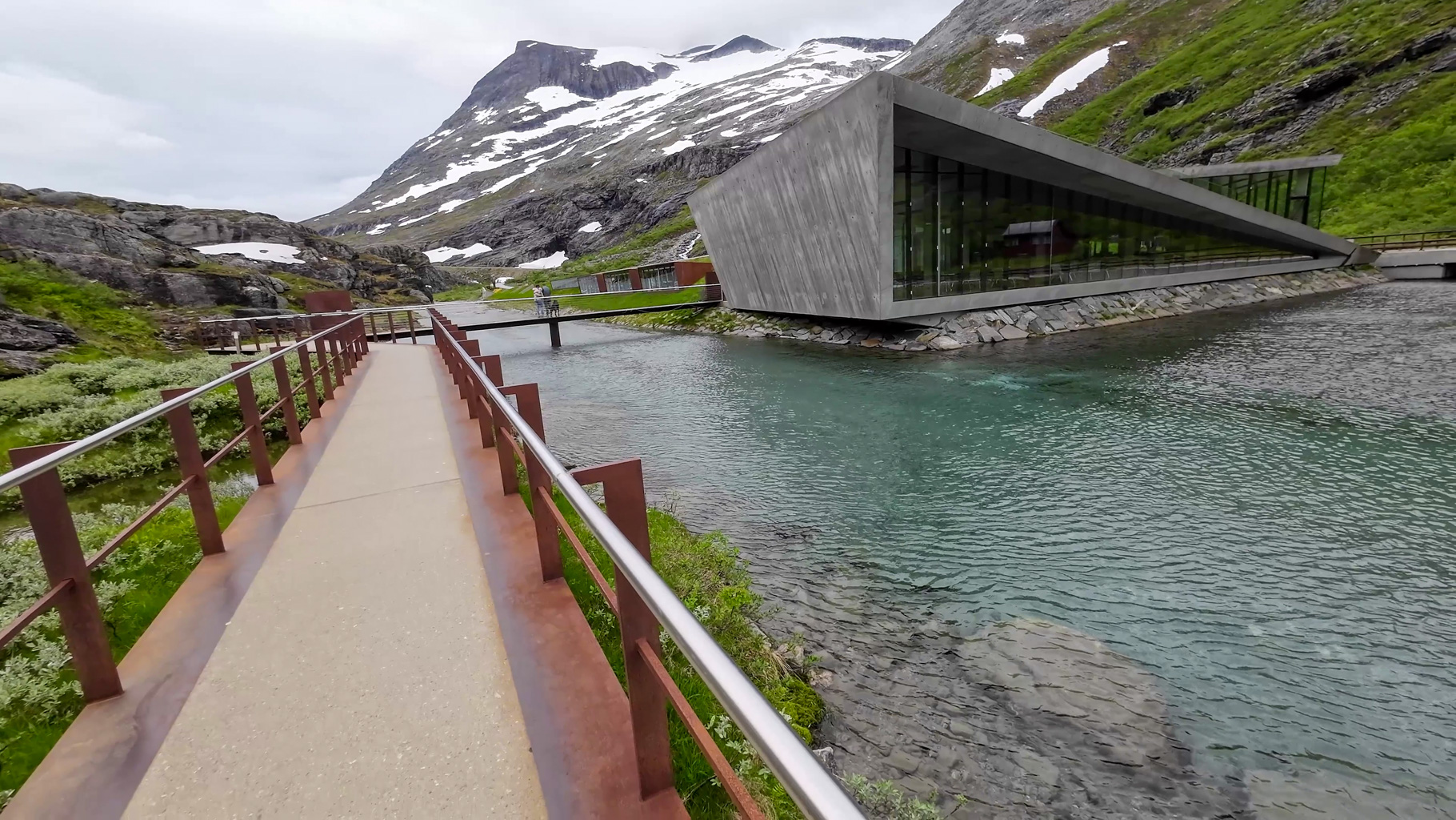
Photo 13: Concrete building with sharp lines and mountain reflections in its windows - the Trollstigen visitor centre by the river in a mountain setting.
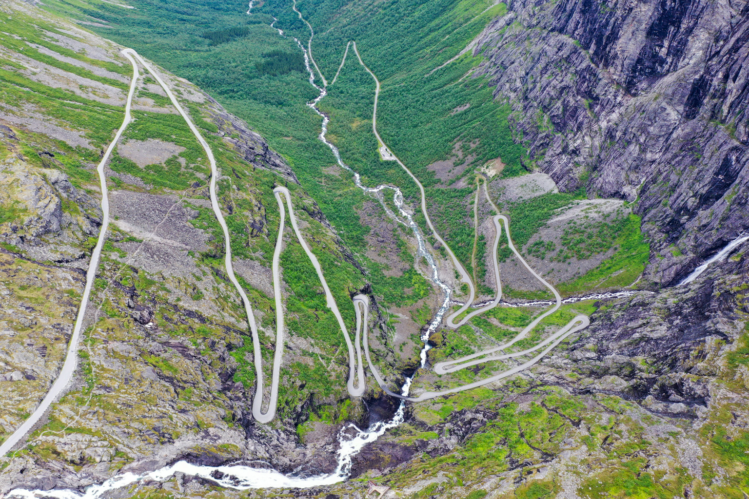
Photo 14: Bird's-eye view of the entire Trollstigen serpentine road.
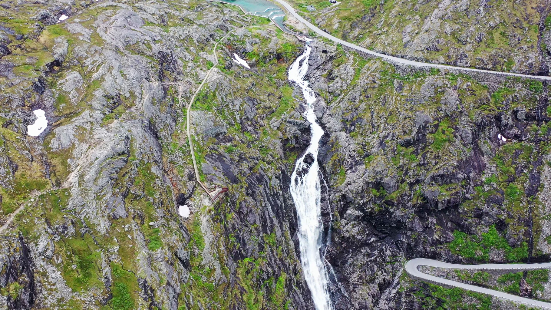
Photo 15: Top-down view of the Stigfossen waterfall and the trail leading to Stabbeskaret.
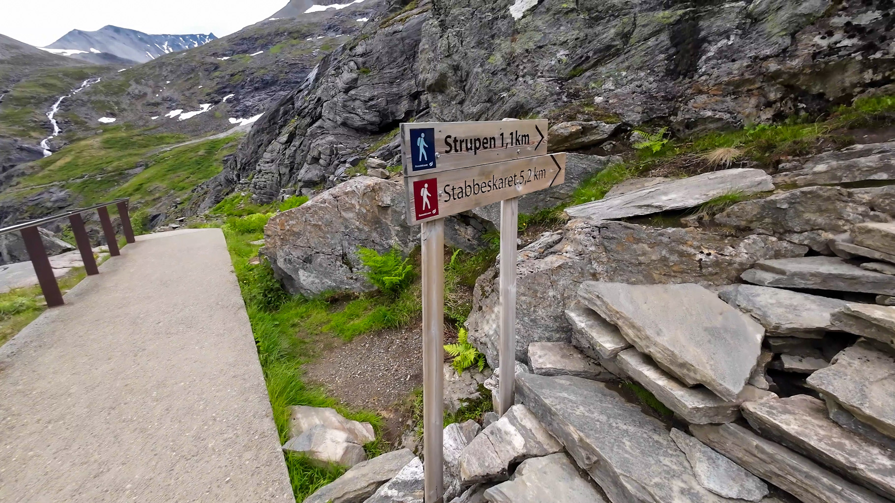
Photo 16: Trail signpost showing the route to the Stabbeskaret pass and the Strupen viewpoint.
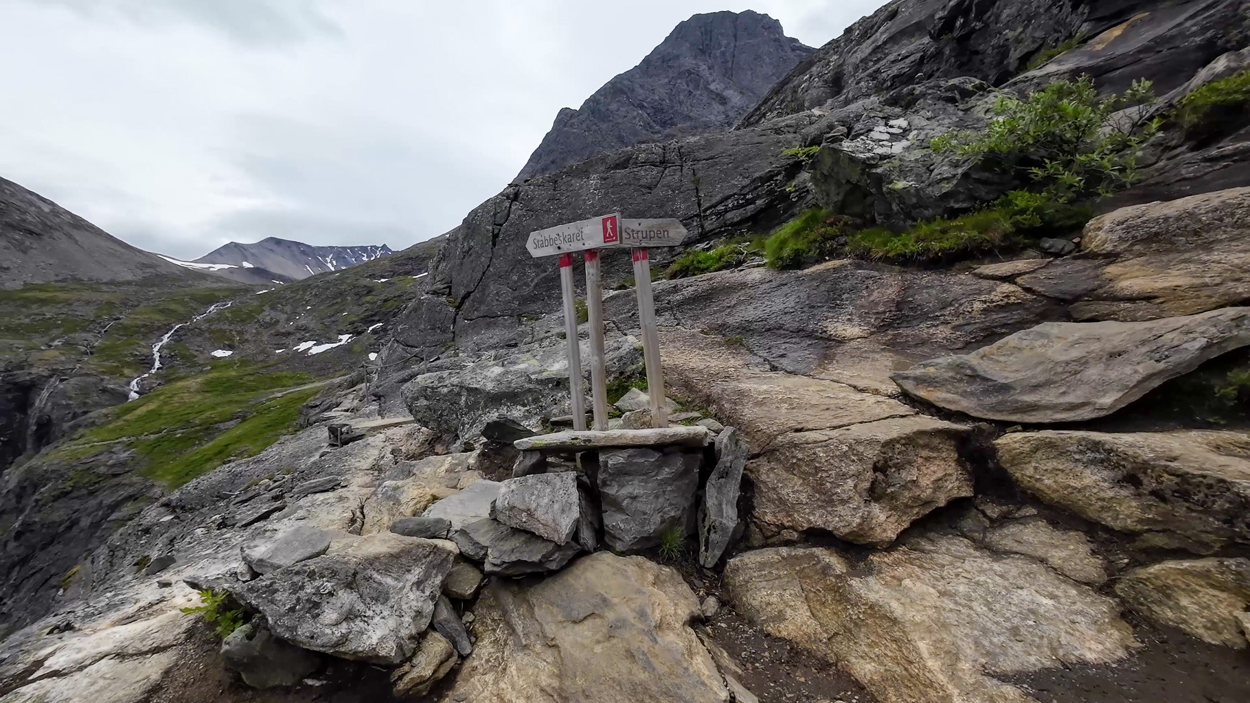
Photo 17: Which way? Left or right? Start of the ascent towards the Stabbeskaret pass.
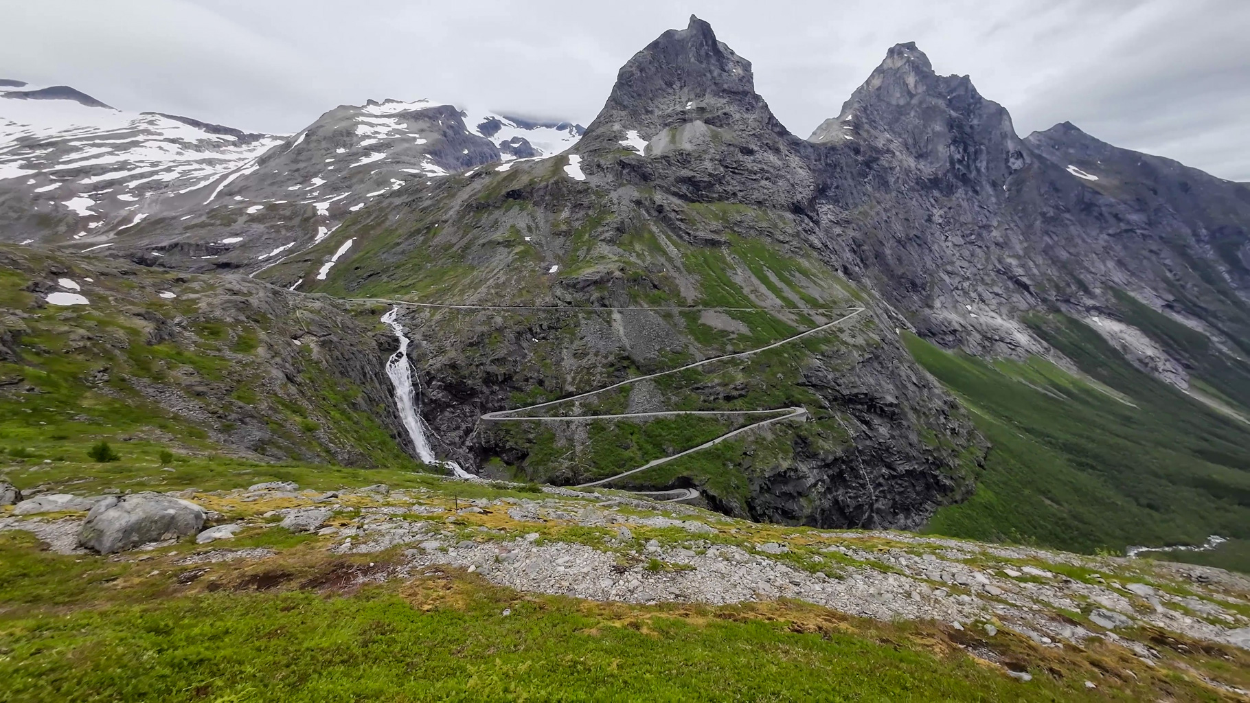
Photo 18: View of the Bispen and Kongen peaks (the Bishop and the King) above Trollstigen during the ascent towards Stabbeskaret.
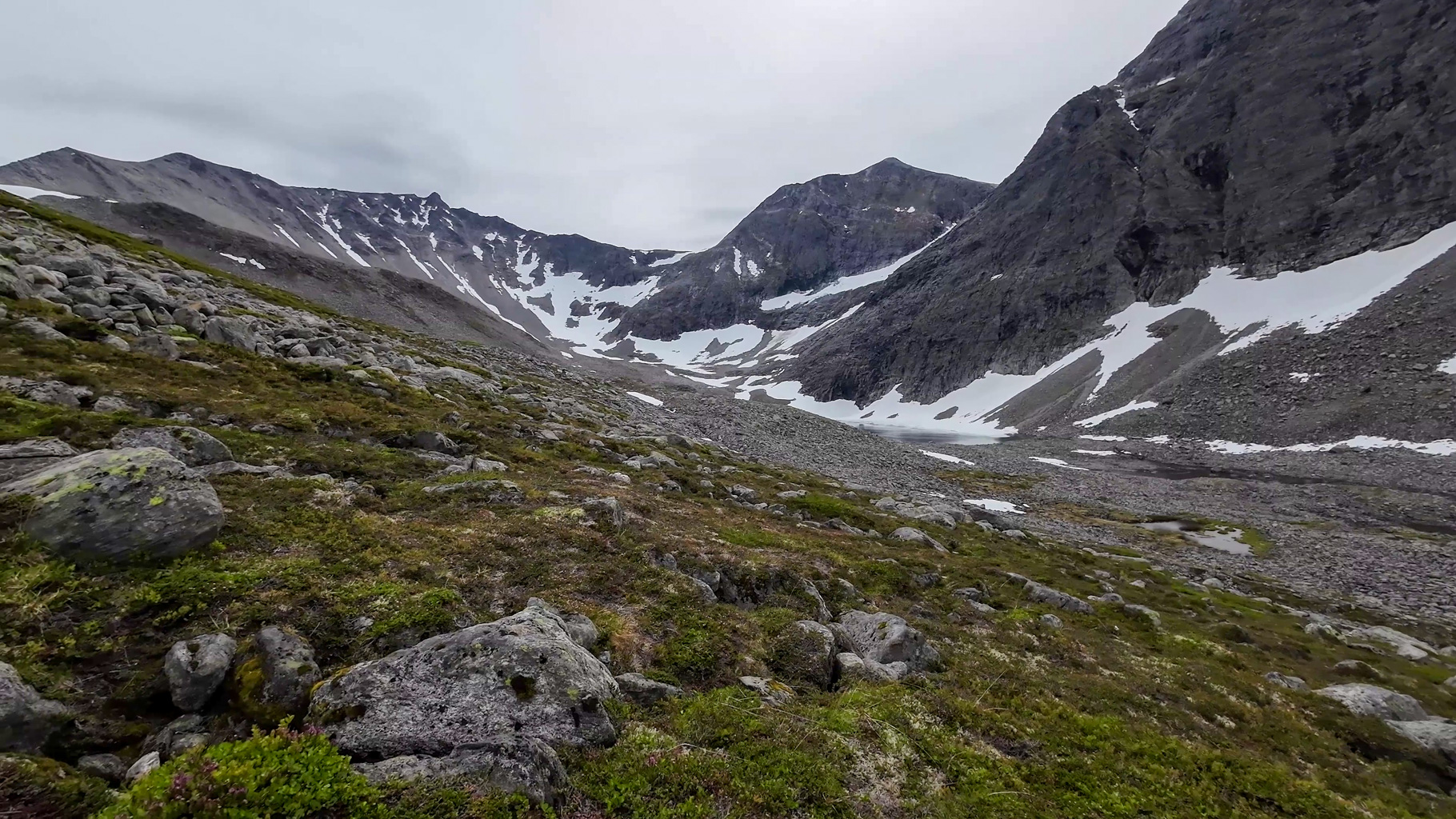
Photo 19: The Stigbotn valley with the trail rising towards Lake Stigbotnvatnet.
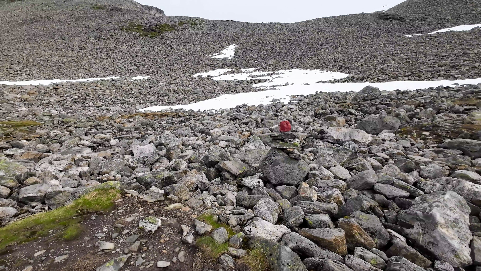
Photo 20: The ascent gets tougher - snowfields, boulders and confusing terrain. Navigating by the red markers and stone cairns is invaluable here.
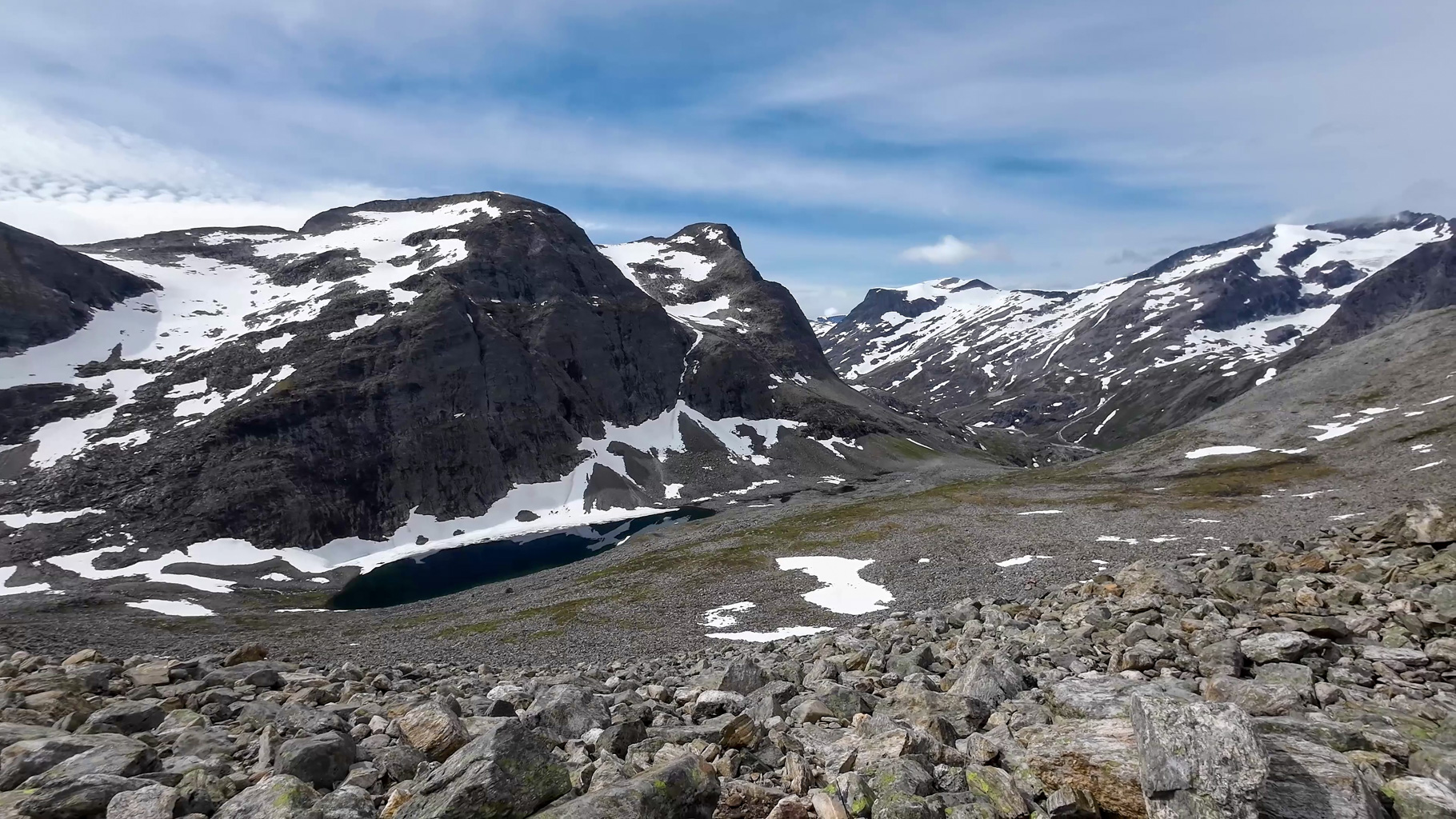
Photo 21: Lake Stigbotnvatnet beneath Stigbotthornet. A dark blue lake still surrounded by snow - typical June scenery in Norway.
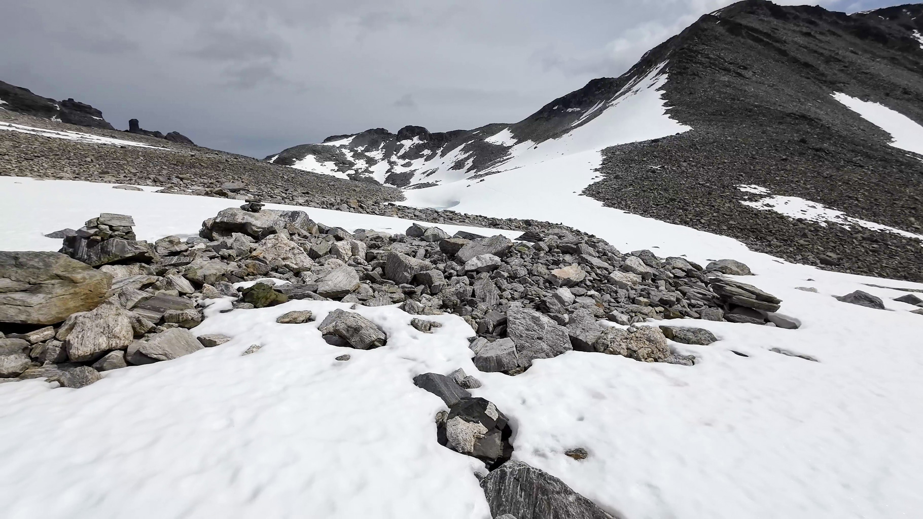
Photo 22: Snowfield in the rising terrain still in June - in some spots the snowdrifts are deep.
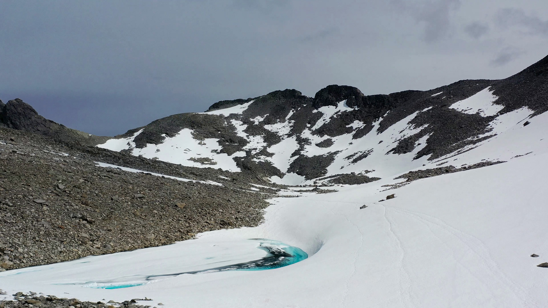
Photo 23: The Stabbeskaret pass (1420 m a.s.l.) appears on the horizon. The path leads across snow, footprints fade, but the destination is near.
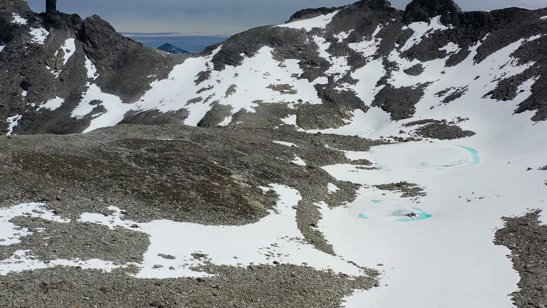
Photo 24: The Stabbeskaret pass on the horizon with several frozen lakes below it.
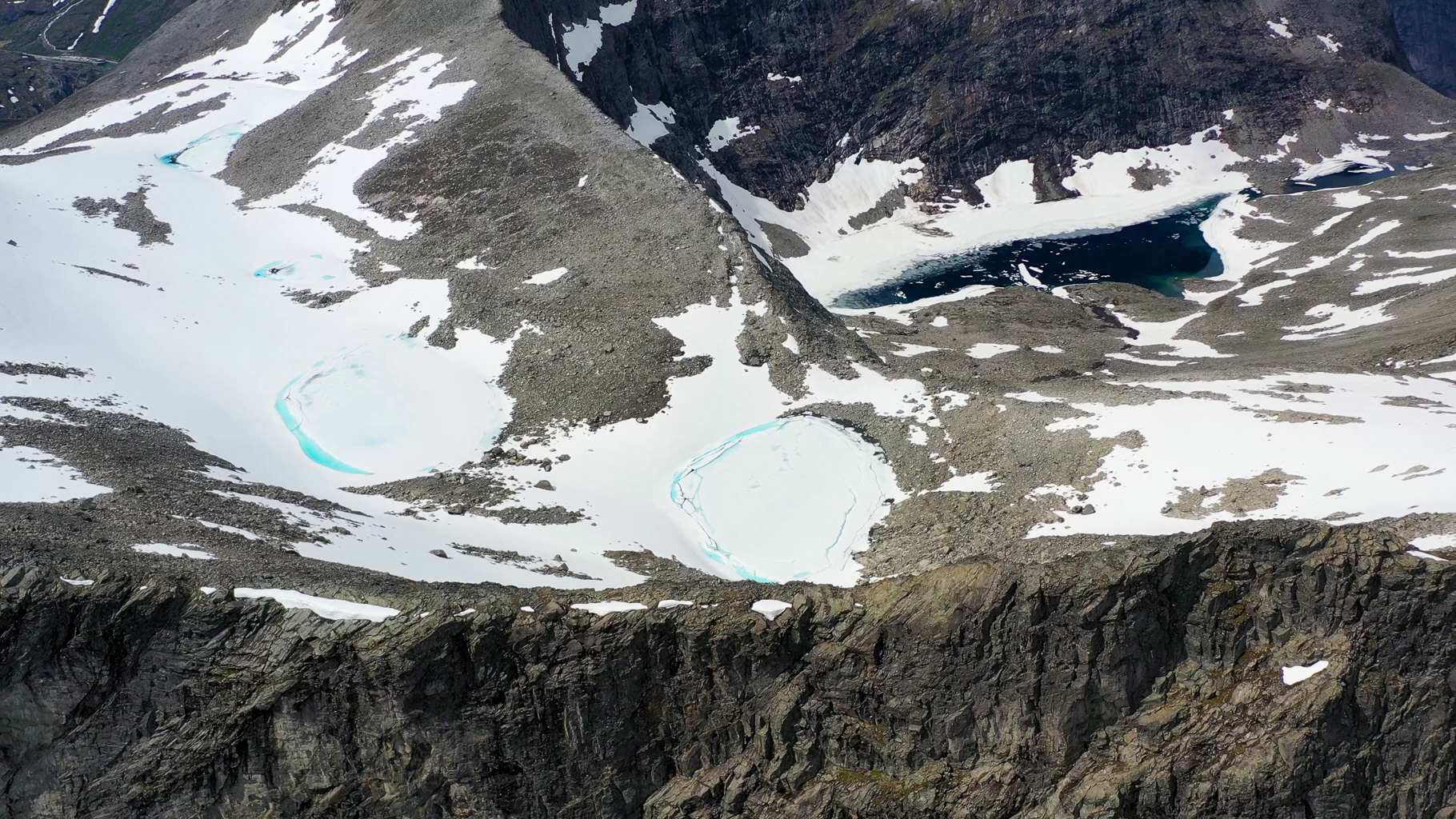
Photo 25: View from the ridge of several frozen glacial lakes between Storgrovfjellet, Stabbeskaret and Store Trolltinden.
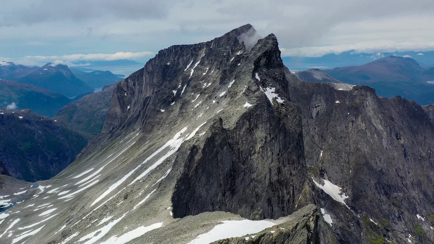
Photo 26: The Stabbeskaret pass with Store Trolltinden towering above it - a monumental cliff, one of the highest in the Romsdal region.
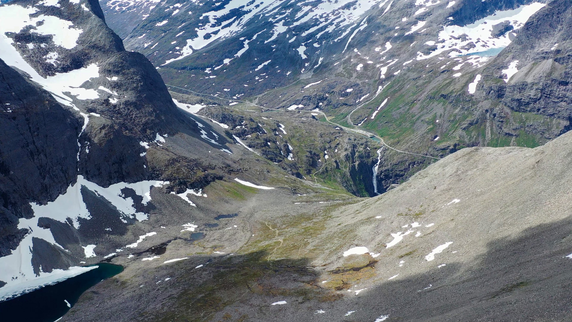
Photo 27: Looking back down the valley with Lake Stigbotnvatnet and the Trollstigen visitor centre.
Video from the hike along the Trolls' Road (Trollstigen) and up to the Stabbeskaret pass.